Are you curious about Leros but not sure where it’s located? Keep reading, and we’ll help orient you! Discover Leros’ dimensions and coastline, including its six main bays: Xirokampos, Pandeli, Alinda, Blefoutis, Partheni, and Gourna.
If you’re not sure where Leros is on the map, or you just need a little help with orientation on this beautiful island, this article is for you.
Leros is a Greek island that is part of the Dodecanese island group, consisting of 12 large islands and numerous smaller ones located in the southeastern Aegean Sea. The name “Dodecanese” comes from the Greek words “dodeka” meaning twelve, and “nesos” meaning island, although there are actually 15 main islands in the group.
Where is Leros located?
Leros is located in the southeastern Aegean Sea, south of Lipsi and Patmos, north of the island of Kalymnos. It’s relatively close to the Turkish coast, the nearest point being approximately 18 kilometers (11.25 miles) away.
Zooming out on the map, you can see that Leros is located approximately 200 kilometers (124 miles) southeast of Athens and 70 kilometers (43 miles) north of Rhodes.
Leros dimensions, size, and numbers
Leros is considered a mid-small island with a total land area of approximately 54 square kilometers (28.5 square miles), including Levitha, Kinaros, and several uninhabited islands around.
Leros coastline is rugged, which creates many bays of all sizes. The total coastline is approximately 71 kilometers (44 miles). You can easily access most bays and beaches by car, while others are accessible only from the sea.
These particular dimensions make Leros one of the few islands where you can drive for 5 minutes and enjoy the view of 4 bays. Hiking or Biking, you can enjoy views of the surrounding seaside from the easily accessible hilltops all around the island.
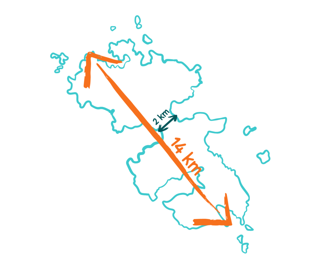
The length from north to south is approximately 14 kilometers (8.7 miles), the maximum width is approximately 8 kilometers (5 miles) from east to west, and the narrowest point width is 2 kilometers (1.2 miles).
Driving from the north to the south of the island takes approximately 25 minutes island by car from the northeast point on the road to the southern end of the road will take you about 25 minutes (17 Kilometers). It could be faster, but you don’t have to drive fast, as there is always something to see on the road to enjoy it.
The island’s highest point is Kleidi, standing at an elevation of 320 meters (1,050 feet) between Partheni and Alinda.
The length from north to south is approximately 14 kilometers (8.7 miles)
Leros coastline
The 71 kilometers of variable Leros coastline create 6 main bays:
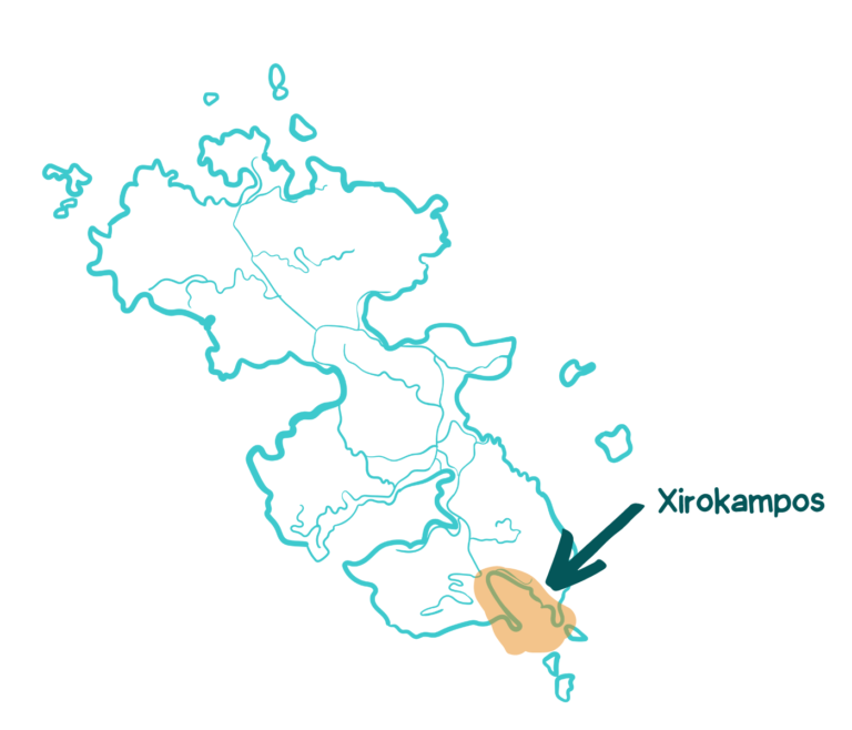
On the south – Xirokampos bay
On the west – Pandeli bay and Alinda (Alinta)
On the East – Lakki and Gourna
On the north – Partheni and Blefouti
Leros offers such a diverse view that each bay has a unique character.
A short overview of the main bays and beaches in Leros is:
Leros bays and beaches
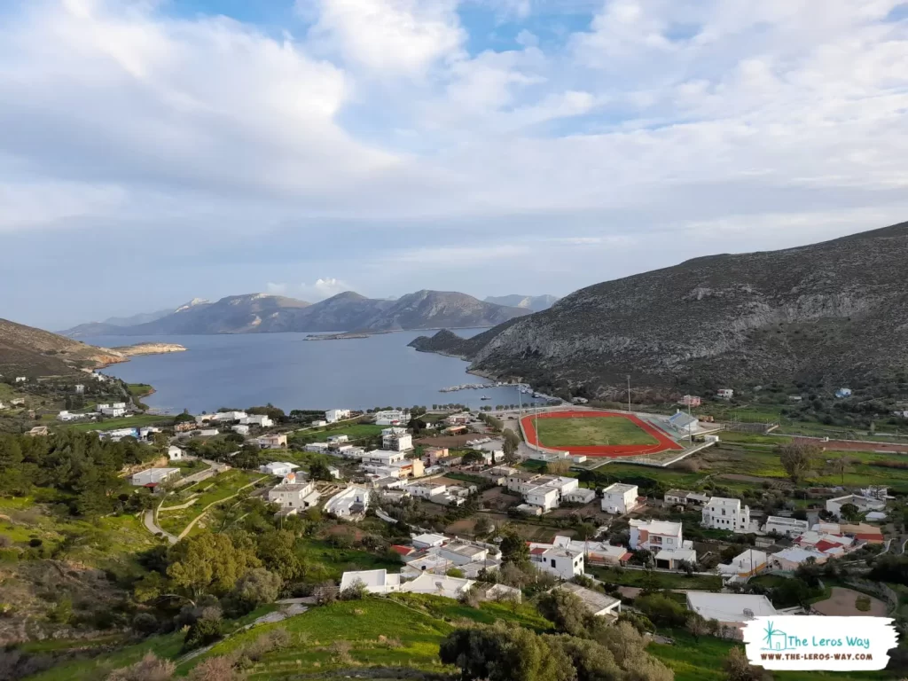
Xirokampos
Xirokampos is a picturesque cove located on the southwest coast of Leros. The bay is a hidden gem, isolated from the rest of the island, and protected from the northern winds, offering visitors a peaceful retreat from the hustle of the more popular tourist areas.
Xirokampus Bay. Photo by Popi Filakouri
Xirokampos is a picturesque cove located on the southwest coast of Leros.
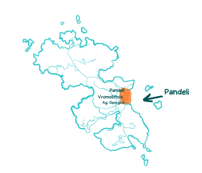
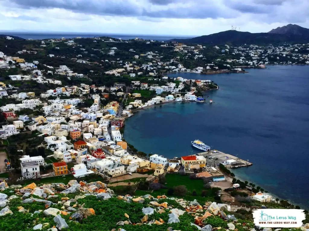
Pandeli
Pandeli is one of the four biggest bays in Leros. It includes 3 main beaches: Agios Georgios beach (in the south), Vromolithos beach (in the center), and Pandeli village, the old fisherman’s village, where you can now enjoy the beach, the taverns, and bar-cafes (in the north).
Pandeli Bay. Photo by Shira Halperin
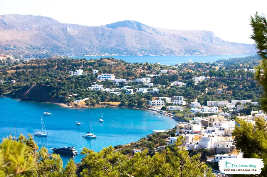
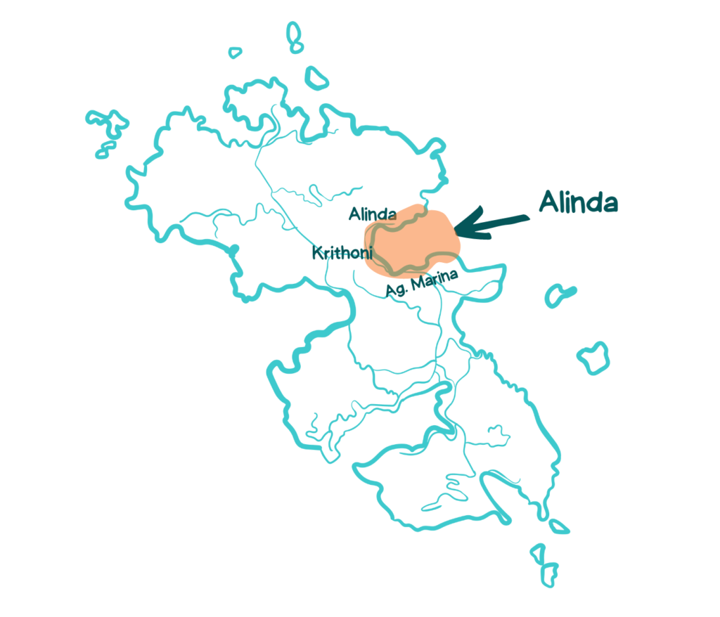
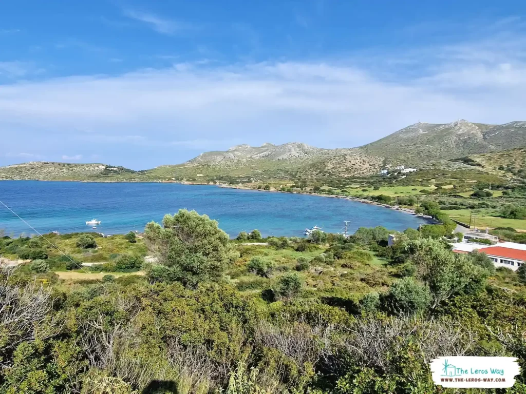
Alinda
Alinda is also one of the biggest bays in Leros, including the traditional Agia Marina village in the south, Krithoni beach (in the center), and Alinda village and beach (in the north). It is known for its easily accessible, family-friendly beaches with crystal-clear waters, making it one of the most popular destinations in Leros.
.
The amazing view from the Castle. Photo by Passenger_84
The biggest bays in Leros, including the traditional Agia Marina village.
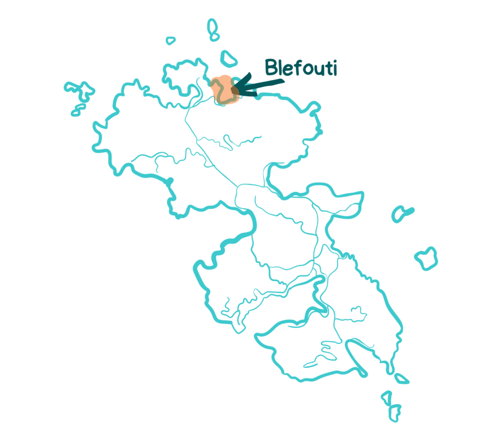
Blefouti
Blefouti is one of Leros’s small, isolated, picturesque beaches with a small fishing dock. Many seaside trees offer natural shade to the bathers. It is mostly protected from the winds, so there are no waves.
The isolated, picturesque Blefouti bay. Photo by Shira Halperin
Blefouti, a picturesque beach with a small fishing dock
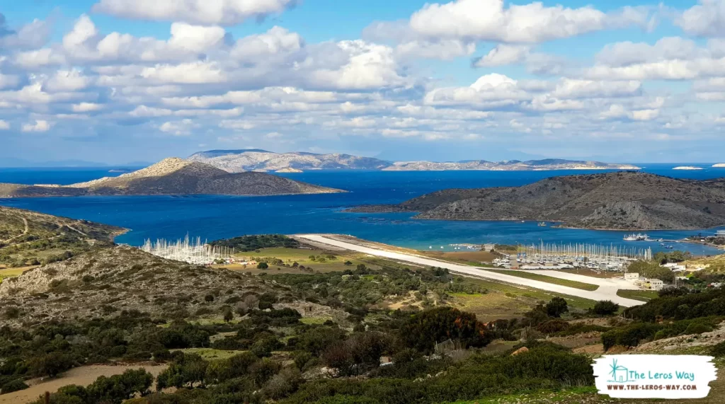
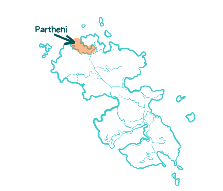
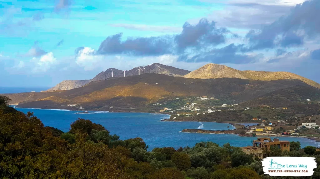
Partheni
Partheni is a beautiful blend of natural landscape areas. The small airport of Leros is located in Partheni, while two big boatyards provide a safe anchorage and maintenance-repair facilities for boats and yachts of all sizes.
Photo by Shira Halperin
Partheni bay, where the airport is located
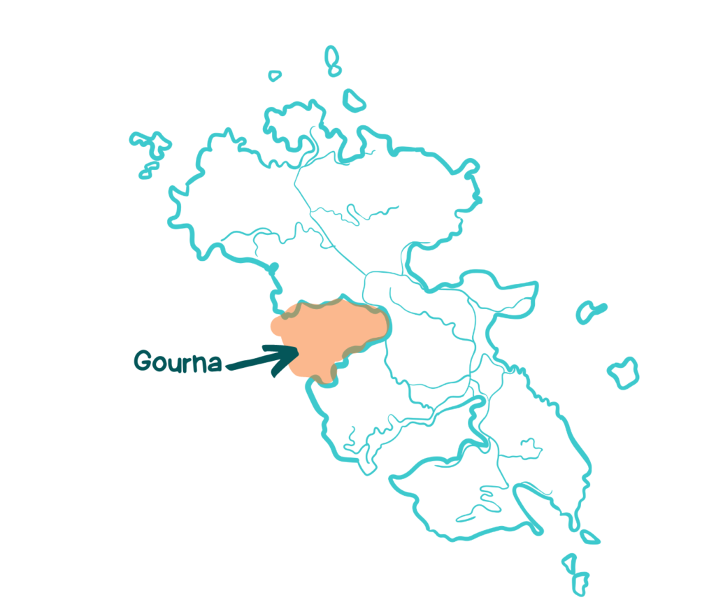
Gourna
Gourna is one of the biggest bays on the island. It offers less-developed natural beauty, and you can enjoy one of the most stunning sunsets on the island. The 3 main beaches are Koukali in the north, Gourna beach (the largest sandy beach on the island), and Drimonas beach and fish harbor (in the north).
Gourna bay. The most stunning sunsets on the island
Gourna, the largest sandy beach on the island
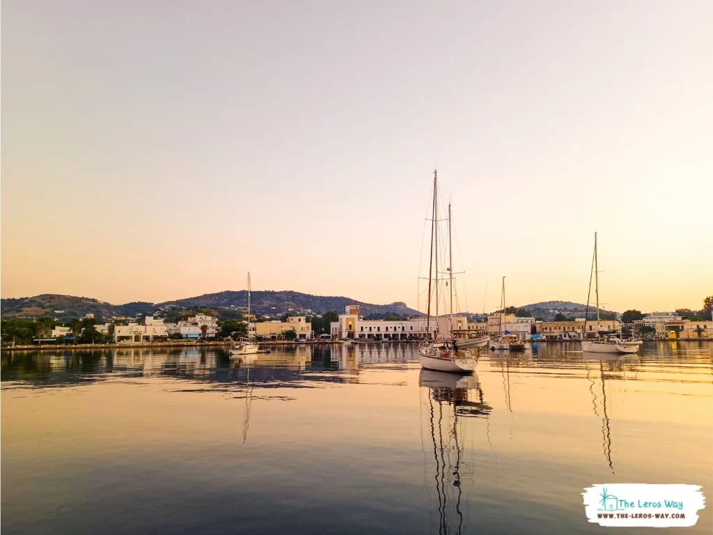
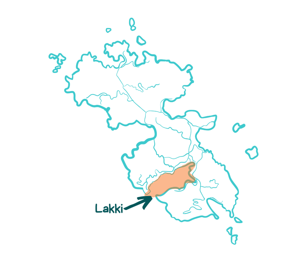
Lakki
Lakki is Leros’s main town and port and one of the largest natural harbors in the Mediterranean Sea.
Lakki town, with its unique rationalist buildings and wide streets, is a fine example of Italian architecture, and it’s considered a historical monument.
The main town and port is on Lakki bay.
Lakki bay - the most protected bay in the Aegean sea.
Inland Settlements
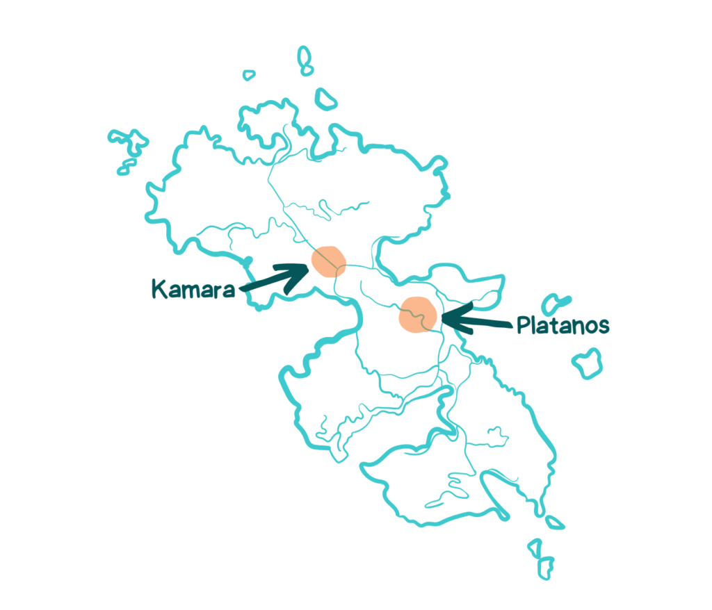
Apart from the seaside villages, also has inland settlements. These are the two main:
Platanos
Platanos, the capital town of Leros, is connected to Agia Marina and Pandeli villages below the slope of the Apittiki Hill, where the Byzantine Castle of Leros stands. As a typical Greek island town, it has whitewashed houses, narrow cobbled streets, a small square, and a municipality. But it also has a twist as it is full of neoclassical mansions built by rich ex-pats more than a century ago.
Kamara
Kamara is a typical non-touristic village located on the sides of the main road between Alinda and Partheni, with small businesses and local shops.
With its rugged coastline, picturesque bays, and unique blend of natural beauty and Italian-influenced architecture, Leros is an island waiting to be explored. This guide has given you an overview of Leros’ location, dimensions, and coastline, including its six main bays. Whether you’re looking to escape the hustle of tourist areas or explore the island’s historic town and port, Leros has something to offer everyone.
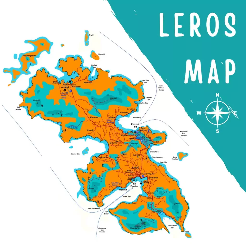
LEROS ORIENTATION MAP
This downloadable map provides a clear overview of Leros, including major towns, villages, and roads. Use it to plan your trip itinerary and navigate the island with ease.
To download the color version of the map, click here.
To download the Black & White version of the map, click here.